Tianqiong Sensor IOT Technology Co., Ltd
Sales Manager:Ms. Emily Wang
Cel,Whatsapp,Wechat:+86 15898932201
Email:info@fengtutec.com
Add:No. 155 Optoelectronic Industry Accelerator, Gaoxin District, Weifang, Shandong, China


Sales Manager:Ms. Emily Wang
Cel,Whatsapp,Wechat:+86 15898932201
Email:info@fengtutec.com
Add:No. 155 Optoelectronic Industry Accelerator, Gaoxin District, Weifang, Shandong, China
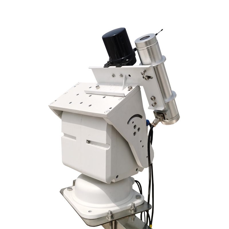
Model:FT-YL1
Brand:tianqiong
Total sky imager detailed product introduction and technical parameters
Total sky imager is an automatic sky imaging system that processes daytime sky conditions in real time, photographing and recording the state of sky cloud cover.Total sky imager uses advanced machine learning technology and cutting-edge big model algorithms, combined with professional optical sensing technology, to accurately calculate the cloud volume in the sky and the proportion of sunlight passing through the clouds, providing more accurate data than traditional methods.
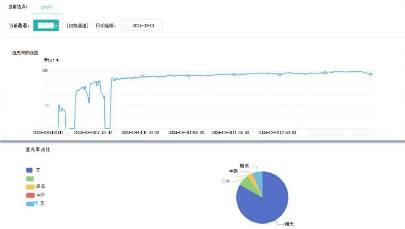
Any lighting environment automatically captures the impact of clouds on sunlight, and the high-sensitivity optical sensor makes the data obtained in any environment more accurate and reliable.
| parameter | (4G version) |
| Yearly stability | ±1% |
| Open corners | 4° |
| Time constant | ≤10S(99% |
| Sampling frequency | 30s~86400s |
| Store data | >180 days |
| Internet connection requirements | 4G |
| Data output | Status flags Cloud level Sun occlusion rate and sky proportion The proportion of the cloud Cloudy proportion Half-yin proportion Cloudy days proportion Latitude data Longitude data Sun's height angle Sun direction angle Transmission curve diagram Full-day proportion analysis chart |
| Output method | APIJson format |
| Operating temperature | -40~80℃ |
| Protection level | IP67 |
| weight | 10kg |
| power supply | DC12-20V |
| Current power consumption | Maximum power consumption 7W, average power consumption of 1W for normal operation |
| Data/power supply cable | 10m (standard) |
The crop growth condition is an important term in the agricultural field, referring to the growth and development status of crops at various stages from sowing to maturity. It includes comprehensive information such as plant morphology, population structure, and physiological indicators, and is cruc...
This instrument integrates FDR (Frequency Domain Reflectometry) principle soil moisture measurement sensors and data acquisition technology. Through moisture and temperature sensors, it accurately measures soil volumetric water content (VWC) and temperature. Powered by solar energy, it is adap...
Traditional visibility monitoring mainly relies on ground-based fixed stations. While these stations can provide continuous data, they have limitations such as limited spatial coverage, high construction costs, and difficulty in mobility. Especially in complex terrain areas (such as mountainous regi...
Five Elements Micrometeorological Instrument, model FT-WQX5S, features an exterior made of stainless steel. This material not only boasts high strength, capable of withstanding a certain degree of external impact, but also exhibits excellent anti-oxidation and anti-corrosion properties. This makes i...


 Get a Free Quote
 Skype
Skype
 whatsapp
 mail
mail