Tianqiong Sensor IOT Technology Co., Ltd
Sales Manager:Ms. Emily Wang
Cel,Whatsapp,Wechat:+86 15898932201
Email:info@fengtutec.com
Add:No. 155 Optoelectronic Industry Accelerator, Gaoxin District, Weifang, Shandong, China


Sales Manager:Ms. Emily Wang
Cel,Whatsapp,Wechat:+86 15898932201
Email:info@fengtutec.com
Add:No. 155 Optoelectronic Industry Accelerator, Gaoxin District, Weifang, Shandong, China
time:2026-11-04 10:19:40 source:Weather Station viewed:1 time
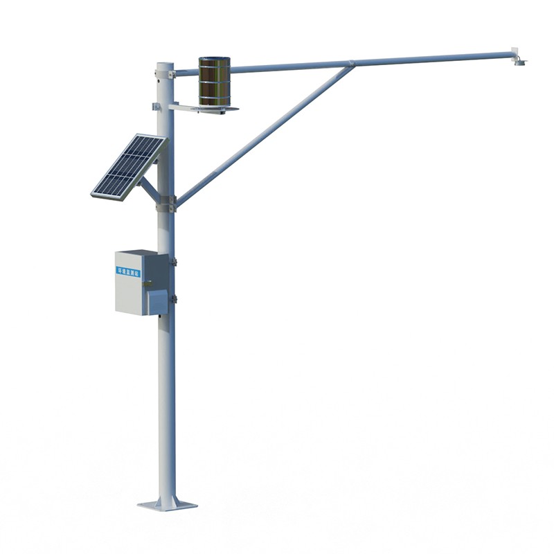
This water level monitoring equipment utilizes K-band planar radar technology for non-contact measurement, enabling the simultaneous acquisition of data on both channel water levels and rainfall. It offers a measurement range of 0.1 to 40 meters with an accuracy of ±1 mm, and can measure rainfall intensity from 0 to 4 mm per minute. Powered by a combination of solar panels and rechargeable batteries, the system is well-suited for automated hydrological monitoring in environments such as rivers, irrigation channels, and underground drainage networks.
In hydrological monitoring, water level and rainfall are two fundamental parameters that must be captured synchronously. Traditional contact-based sensors are prone to interference from sediment accumulation, water corrosion, and floating debris over long-term operation; this necessitates frequent maintenance and makes it difficult to ensure data continuity. Non-contact measurement using microwave radar technology offers an alternative solution to these challenges.
The core component of the monitoring equipment is a K-band planar radar module. During operation, the radar antenna emits microwave signals toward the water surface; these signals are reflected off the water and captured by a receiving unit. An internal algorithm calculates the distance from the antenna to the water surface based on the time delay of the signal's round trip, which is then combined with the installation height to determine the actual water level. Because the sensor does not come into physical contact with the water, factors such as sediment content, pollutant concentrations, or the presence of floating debris do not directly affect the measurement results. The system covers a distance range of 0.1 to 40 meters, making it highly versatile for standard channels and pipe networks. With a resolution of 1 mm and an accuracy of ±1 mm, it is capable of detecting even subtle changes in water level.
Rainfall is monitored via an integrated rain-sensing unit. It features a 200 mm collection aperture, a rainfall intensity measurement range of 0 to 4 mm per minute, a resolution of 0.2 mm, and an accuracy of ±0.2 mm. Rainfall and water level data are recorded synchronously by the same data acquisition system, eliminating the temporal alignment discrepancies often associated with separate, standalone devices. The sampling interval can be configured between 1 and 5,000 minutes, allowing users to adjust data density based on monitoring objectives—shortening the interval during critical flood-control periods and extending it during routine operations to conserve power.
For power supply, the water-level monitoring equipment utilizes a combination of solar panels and rechargeable batteries. This configuration ensures continuous operation in remote locations, such as canal sections or pipeline network nodes, where mains power is unavailable. The system features low overall power consumption and incorporates sleep/wake mechanisms, enabling the battery to sustain operation even during prolonged periods of overcast or rainy weather. Its compact design also simplifies installation, requiring minimal structural support or civil work; the unit can be easily secured to existing poles or walls.
In terms of application, water-level fluctuations in rivers and irrigation canals are directly linked to flood-control management and irrigation water distribution. A non-contact measurement method mitigates the risk of the equipment being damaged by water currents or entangled by debris. In underground drainage networks—characterized by confined, humid environments—radar-based sensing remains unaffected by water vapor or sediment, ensuring stable data output. For flood early-warning systems, the simultaneous collection of water-level and rainfall data provides a multi-dimensional basis for threshold-based decision-making. Since the response priority differs depending on whether a single parameter or both parameters exceed their respective thresholds, having synchronized data facilitates more informed and appropriate response actions.
By integrating both water-level and rainfall monitoring onto a single platform, the equipment reduces the number of on-site devices and the complexity of cabling. For monitoring locations that require long-term, unattended operation—often in areas with limited access for maintenance—this integrated design is highly practical, as it reduces the frequency of required on-site interventions.
Compared with traditional embedded sensors, the Road Condition Monitor has distinct advantages in practical applications. It adopts non-intrusive installation, which does not require damaging the road surface structure. The installation process is simple and convenient, which can greatly reduce the...
These portable anemometers are easy to operate, equipped with precision sensors to measure wind speed, direction, and average wind speed. An internal storage chip stores long-term monitoring data, making them suitable for field meteorological monitoring across various industries....
I. Core Hardware Configuration(I) Meteorological SensorsBasic Elements: Wind speed, wind direction, air temperature, humidity, atmospheric pressure, rainfall, and light intensity sensors should be equipped as basic standards. The accuracy of each sensor should meet national meteorological instrument...
The handheld weather station is a portable observation instrument that integrates wind speed, wind direction, temperature, humidity, atmospheric pressure, altitude and other meteorological elements. It uses precision sensors and smart chips and has built-in large-capacity storage chips. It can...



 Skype
 whatsapp
 mail