Tianqiong Sensor IOT Technology Co., Ltd
Sales Manager:Ms. Emily Wang
Cel,Whatsapp,Wechat:+86 15898932201
Email:info@fengtutec.com
Add:No. 155 Optoelectronic Industry Accelerator, Gaoxin District, Weifang, Shandong, China


Sales Manager:Ms. Emily Wang
Cel,Whatsapp,Wechat:+86 15898932201
Email:info@fengtutec.com
Add:No. 155 Optoelectronic Industry Accelerator, Gaoxin District, Weifang, Shandong, China
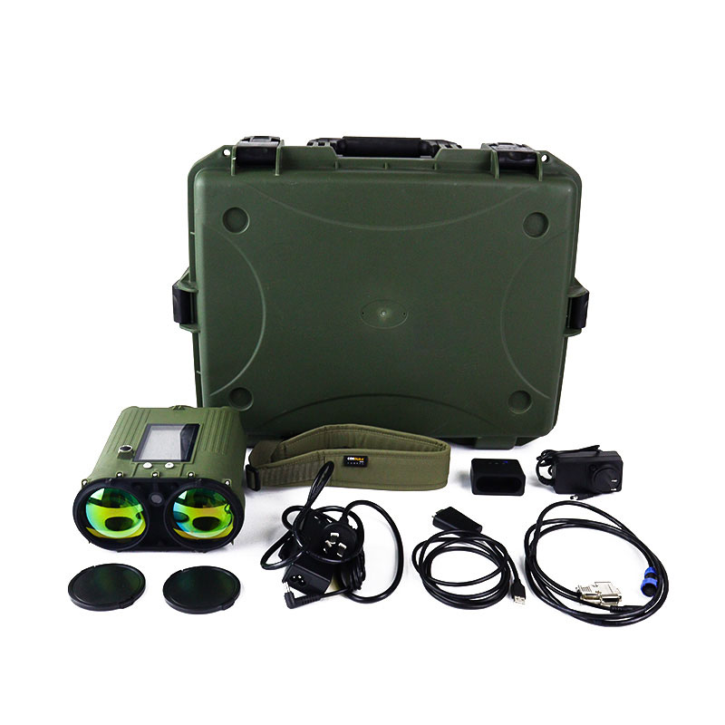
Model:FT-YG2
Brand:tianqiong
1、Cloud Height Measurement Product Overview
Cloud Height Measurement accurately measures the ceiling or base height of clouds, which is the distance between the base of the cloud and the top of the cloud.Cloud Height Measurement is an advanced meteorological and environmental monitoring device that utilizes lidar technology to measure cloud height, thickness, and multi-layer cloud information. It features a lightweight design, low power consumption, and simple, convenient operation. Applicable scenarios for this product include airports, ships, and training facilities. Its operating environments span inland regions, maritime areas, and high-altitude plateaus.
2、Cloud Height Measurement Key Features
a) Cloud Base Height Measurement: Emits vertical laser pulses toward the sky; by precisely calculating the time difference between the laser signal reaching the cloud base and returning to the instrument, it accurately measures the cloud base height.
b) Multi-Layer Cloud Differentiation: Features multi-layer cloud detection capabilities, allowing it to penetrate cloud layers to identify and calculate the structure of up to three distinct cloud layers, while simultaneously reporting the cloud base height for each individual layer.
c) Observation Mode Switching: Offers flexible observation modes. Users can select a single-measurement mode to quickly obtain current data, or choose a continuous automatic observation mode to monitor the dynamic changes in cloud height over extended periods.
d) Data Recording and Transmission: Capable of storing both raw data and measurement results; supports the querying and exporting of historical data, and facilitates external communication via an RS485 interface.
e) Auxiliary Aiming: Facilitates aiming through the use of a built-in aiming reticle on the device body, supplemented by a live video feed displayed on the LCD screen.
f) Display Function: Equipped with an LCD screen that provides real-time displays of current cloud height, battery level, device status, and other relevant information.
g) Dual Power Supply (Battery and External): Features a dual-source power supply design. It includes a built-in, high-capacity rechargeable lithium battery to support extended mobile field operations, and is simultaneously equipped with an external power input port. When connected to an external power source, the device automatically switches to external power supply mode and charges the internal battery, ensuring uninterrupted operation and meeting the requirements for long-term monitoring at fixed locations.
h) Tripod Mount: The bottom of the device body features a standard universal 1/4-inch threaded interface, allowing for convenient mounting on professional tripods. This feature effectively minimizes measurement errors caused by hand tremors during handheld operation, thereby enhancing stability and data accuracy during prolonged, continuous observation sessions.
3、Cloud Height Measurement Performance Specifications
3.1 Measurement Performance
a) Detection Range: 50 m – 10,000 m;
b) Spatial Resolution: 5 m;
c) Measurement Accuracy: ±5 m (for solid targets);
d) Detectable Cloud Layers: 3 layers;
e) Pitch Angle: Range 0° – 90°;
f) Azimuth Angle: Range 0° – 360°;
g) Data Output Frequency: 10 s (single measurement), 60 s (continuous mode).
3.2 Physical Characteristics
Weight: ≤ 2 kg;
Dimensions (L × W × H): ≤ 225 × 195 × 115 mm.
3.3 Electrical Characteristics
a) Battery: Lithium battery, 10.8 V / 5400 mAh;
b) Power Supply: DC 19 V (for operation and charging);
c) Charging Time: ≤ 2.5 h;
d) Operating Duration: ≥ 500 measurements (Manual Mode); ≥ 6 h (Automatic Continuous Mode);
e) Communication Interface: RS485; Baud Rate: 115,200 bps; Max. Wired Transmission Distance: ≥ 300 m;
f) Power Consumption: ≤ 7 W.
3.4 Environmental Adaptability
a) Operating Environment: Temperature -40°C – 50°C;
b) Operating Humidity: 0 – 95% RH (at 30°C);
c) Enclosure Protection Rating: IP65; Salt-fog resistant; Corrosion-resistant.
The ground-based meteorological observation station features a carbon fiber body, integrates a ten-element sensor module, and comes with multi-functional supporting equipment. It supports multi-mode data transmission and boasts high protection, high precision, and low power consumption. It can...
The Negative Oxygen Ion Monitoring System is a monitoring framework built on professional technologies, with its core technical architecture integrating sensing technology and IoT communication technology. The sensor employs a universal capacitive detection principle to measure the concentration of...
The Ultrasonic weather station utilizes ultrasonic technology to measure meteorological elements. When ultrasonic waves propagate in the air, their propagation speed is affected by air flow. When the wind blows from different directions, the propagation times of ultrasonic waves in the downwind and...
Combustion is a common energy conversion method.During combustion, flue gas is emitted. Analyzing its composition—primarily components like oxygen, carbon monoxide (CO), and carbon dioxide (CO₂)—helps determine if combustion is complete and calculate combustion efficiency.The level of combustion...


 Get a Free Quote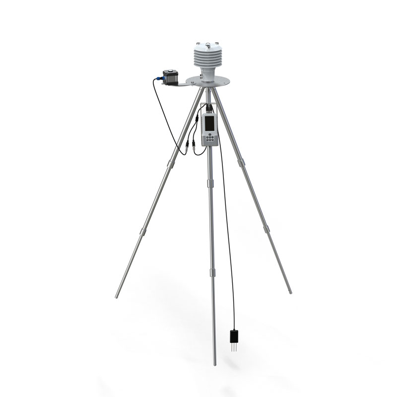
 Skype
Skype
 whatsapp
 mail
mail