Tianqiong Sensor IOT Technology Co., Ltd
Sales Manager:Ms. Emily Wang
Cel,Whatsapp,Wechat:+86 15898932201
Email:info@fengtutec.com
Add:No. 155 Optoelectronic Industry Accelerator, Gaoxin District, Weifang, Shandong, China


Sales Manager:Ms. Emily Wang
Cel,Whatsapp,Wechat:+86 15898932201
Email:info@fengtutec.com
Add:No. 155 Optoelectronic Industry Accelerator, Gaoxin District, Weifang, Shandong, China
Model:FT-LMZK2
Brand:tianqiong
1.Road Surface Condition product introduction
Road Surface Condition is an important indicator in road safety research and can be used by transportation departments for road safety research.Road Surface Condition uses remote sensing technology to avoid damage to the road and thus avoid traffic interference caused by the installation of road weather stations.
Under road conditions where embedded pavement sensors are inconvenient or cannot be installed, remote sensing installation means that there is no need to close the road or cut the pavement, and the installation work is both safe and convenient.Low maintenance is an ideal choice for road meteorological systems.
It can be installed on existing weather stations or on other buildings with unobstructed views of the road surface.
Multi-spectral measurement technology enables accurate detection of the thickness of icy, snow and water on the surface of the road.
By providing road surface condition information, road management departments provide accurate monitoring data and take response measures before road safety risks occur.
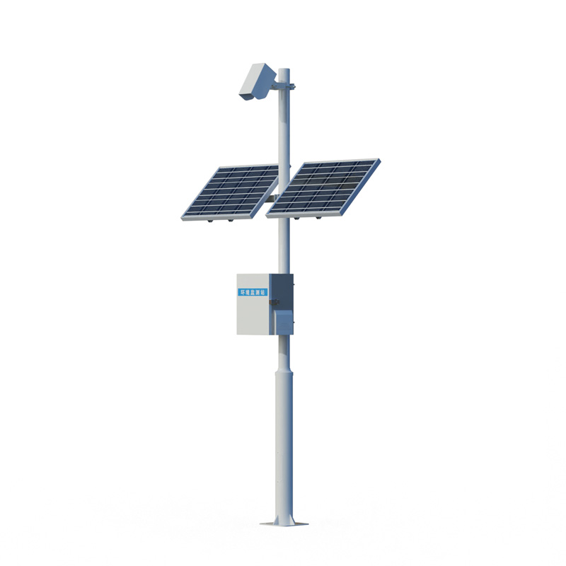
2.Road Surface Condition system composition: road condition sensor, collector, pole bracket, power supply system, cloud platform
3.Road Surface Condition product application
1.Install the bridge surface from a long distance
2.Areas with frequent accidents
3.Areas with large traffic flow
3.Areas with frequent rain and snow
4.Road Surface Condition product features
1.Long-distance measurement of road area water, ice and snow
2.Measure the road surface status
3.Measure the degree of water accumulation, ice surface, and slipperyness
4.Non-buried design
5.Resistant to rust
6.Infrared detection up to 15 meters
7.No need to close the lane, easy installation and maintenance
8.Rustrated design, all-weather measurement
5.Road Surface Condition Technical Parameters
| Monitoring distance | 2-15 meters | ||
| Detection diameter | 23cm | ||
| angle | 30-90 degrees | ||
| Power input | 220VAC, 24VDC | ||
| Maximum power consumption | 5W (including lens heating) | ||
| Operating temperature | -38ºC to +70ºC | ||
| Working humidity | Degree 0 to 100% | ||
| Road state parameter output | Road area water thickness: 0.00-10mm | Resolution: 0.01mm | Accuracy: 0.1mm |
| Pavement ice thickness: 0.00-10mm | |||
| Road area snow thickness: 0.00-10mm | |||
| The degree of slippery road surface: 0.00-1 | Resolution: 0.01 | ||
| (*) Pavement temperature: -38ºC to +60ºC | |||
| (*) Pavement humidity: 0-100% | |||
| (*) Ambient temperature and humidity: -40ºC to +70ºC | |||
| (*) Atmospheric pressure: 150-1100hPa | |||
| Pavement status report | Dry, damp, wet, snow, ice, ice water mixed (*frost) | ||
| Lens pollution detection | Pollution level measurement of optical lenses and internal automatic pollution compensation | ||
| Pavement materials | Concrete and asphalt pavement | ||
| communication | RS485, RS232 | ||
| Average no trouble | 10 years | ||
| Safety | No safety issues – infrared remote sensing measurement technology | ||
The next-generation standard Farmland Weather Station deeply integrates IoT (Internet of Things) technology and big data analysis. As a crucial tool in modern agricultural production monitoring, it provides farmers with full-process production data support from sowing to harvest.The station is speci...
I. Core Hardware Configuration(I) Meteorological SensorsBasic Elements: Wind speed, wind direction, air temperature, humidity, atmospheric pressure, rainfall, and light intensity sensors should be equipped as basic standards. The accuracy of each sensor should meet national meteorological instrument...
Portable Weather Station is a highly integrated, low-power, and rapidly deployable high-precision automatic meteorological observation device. It is suitable for various scenarios such as emergency short-term meteorological observation, mobile meteorological monitoring, and microclimate environment monitoring. It is primarily used for data acquisition in fields such as meteorology, agriculture and forestry, environmental protection, and emergency monitoring....
Water is the lifeblood of plant growth, permeating throughout their entire life cycle. Plants mainly rely on their roots to absorb water, and this water participates in numerous physiological activities within the plant.Photosynthesis is the core process of plant growth. Water and carbon dioxide und...


 Get a Free Quote

 Skype
Skype
 whatsapp
 mail
mail