Tianqiong Sensor IOT Technology Co., Ltd
Sales Manager:Ms. Emily Wang
Cel,Whatsapp,Wechat:+86 15898932201
Email:info@fengtutec.com
Add:No. 155 Optoelectronic Industry Accelerator, Gaoxin District, Weifang, Shandong, China


Sales Manager:Ms. Emily Wang
Cel,Whatsapp,Wechat:+86 15898932201
Email:info@fengtutec.com
Add:No. 155 Optoelectronic Industry Accelerator, Gaoxin District, Weifang, Shandong, China
time:2026-05-18 11:01:56 source:Weather Station viewed:193 time
The construction of hydrological monitoring station networks in irrigation districts utilizes microwave radar technology to measure water level, flow velocity, flow rate, and rainfall in channels in a non-contact manner. This method is unaffected by silt and floating debris, providing high-precision hydrological data for irrigation district water resource management.
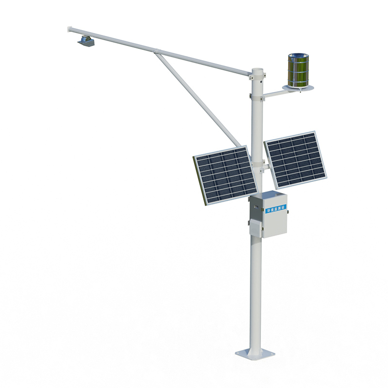
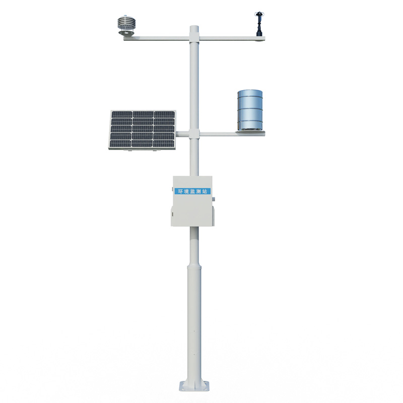
The construction of hydrological monitoring station networks in irrigation districts is the technological foundation for achieving refined water resource management. Traditional hydrological measurement methods mostly use contact equipment, with sensors immersed in the water body for measurement. In actual operation in irrigation districts, this faces prominent problems such as siltation and blockage, entanglement with floating debris, and equipment corrosion and aging. The operation and maintenance costs of monitoring stations are high, and data continuity is difficult to guarantee. With the continued construction and modernization of the Zhongxi Irrigation District, 260 automatic water measurement stations and 151 water level monitoring stations were newly built as part of the information technology construction. The Wuling Irrigation District has constructed 35 water level and flow monitoring stations. The core equipment in these station network constructions has begun to adopt non-contact microwave radar measurement technology. This technology uses K-band plane radar waves emitted into the water body to measure the surface velocity of the water flow using the Doppler effect. Simultaneously, a radar ranging module acquires the water level. The sensor is suspended approximately 3 to 4 meters above the channel, never contacting the water, thus fundamentally avoiding the problem of the sensor being clogged or entangled by silt, weeds, and floating debris.
Currently, the mainstream equipment used in the construction of irrigation district hydrological monitoring network adopts an integrated radar water level and flow velocity sensor design. This sensor can simultaneously measure two key parameters: water level and flow velocity. Combined with the channel cross-sectional geometry, it automatically calculates instantaneous and cumulative flow using the flow velocity area method. Some models also integrate a tipping bucket rain gauge interface, achieving integrated monitoring of four parameters: water level, flow velocity, flow rate, and rainfall. The water level measurement range can reach 30 meters with an accuracy controlled within ±1 to 2 millimeters, while the flow velocity measurement range is 0.15 to 21 meters per second with a resolution of ±1 millimeter per second. The Cihuai New River Irrigation District in Anhui Province has constructed 55 water level monitoring stations and 74 flow monitoring stations as part of its sensing system construction. It also shares data from 30 rain gauge stations, essentially achieving real-time online monitoring of all elements of the system. The monitoring stations utilize a pole-mounted deployment scheme, consisting of radar flow meters, telemetry terminals, and a solar power system. Installation only requires erecting a pole on one side of the canal bank and fixing the radar sensor to a horizontal arm extending directly above the canal. This requires no large construction equipment, minimizes civil engineering work, and allows for rapid construction, making it particularly suitable for linear deployments of multiple stations along main and branch canals.
After the irrigation district's hydrological monitoring network was completed, the water level, flow velocity, flow rate, and rainfall data collected by each station are uploaded to the irrigation district's information management platform via 4G or fiber optic networks through the telemetry terminals. Management personnel can remotely view real-time hydrological information and water level trend maps for each monitoring section. When the monitored water level or flow rate exceeds a set threshold, the system automatically sends out early warning information, supporting the irrigation district management department in timely adjustments to gate openings and water distribution plans. The practical application of the radar flow measurement intelligent service platform in the Bayingou River Irrigation District of Xinjiang has verified the effectiveness of this technology in data acquisition under high sediment conditions. In the construction of the digital twin irrigation district, the data provided by these hydrological monitoring stations constitute the underlying data source for the digital twin of the irrigation district, providing reliable real-time input for the operation of water supply and demand prediction models and flood forecasting models, further enhancing the decision-making support capabilities for water resource allocation and flood control and disaster relief in the irrigation district.
In tourist attractions, air quality is one of the important factors attracting visitors. As a key indicator for measuring air quality, negative oxygen ion concentration has received increasing attention from more and more scenic spots. Known as the "vitamin of the air," negative oxygen ion...
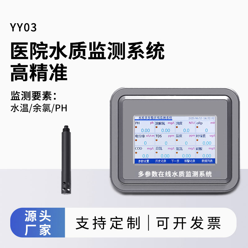
Based on IoT technology, this simplified multi-parameter water quality monitoring terminal integrates sensors for residual chlorine, pH, water temperature, turbidity, and conductivity, and is used in water supply terminals with pipe pressures below 0.3 MPa. The device features data acquisition...
In the fields of solar energy resource assessment and meteorological monitoring, the Fully Automatic Solar Spectrometer is revolutionizing traditional measurement methods. This instrument combines multi - spectral filters with thermopiles to capture radiant energy within the spectral range of 280 to...
The next-generation standard Farmland Weather Station deeply integrates IoT (Internet of Things) technology and big data analysis. As a crucial tool in modern agricultural production monitoring, it provides farmers with full-process production data support from sowing to harvest.The station is speci...


 Skype
Skype
 whatsapp
 mail
mail