Tianqiong Sensor IOT Technology Co., Ltd
Sales Manager:Ms. Emily Wang
Cel,Whatsapp,Wechat:+86 15898932201
Email:info@fengtutec.com
Add:No. 155 Optoelectronic Industry Accelerator, Gaoxin District, Weifang, Shandong, China


Sales Manager:Ms. Emily Wang
Cel,Whatsapp,Wechat:+86 15898932201
Email:info@fengtutec.com
Add:No. 155 Optoelectronic Industry Accelerator, Gaoxin District, Weifang, Shandong, China
time:2025-07-29 09:00:21 source:Weather Station viewed:499 time
Reservoirs are important projects for water resource regulation, and discharge operations directly affect the hydrological conditions of downstream rivers. Discharge is usually divided into different situations such as regular discharge, flood control discharge and emergency discharge. Regular discharge is a common operation in the daily operation of reservoirs, mainly used to maintain the basic ecological flow of downstream rivers, meet the needs of irrigation water, or ensure navigation conditions. This discharge method has a relatively stable flow rate, gentle water level changes, and little impact on downstream rivers. Flood control discharge occurs during the flood season. When the reservoir water level exceeds the flood limit level, it is necessary to increase the discharge through flood discharge facilities to ensure the safety of the dam. At this time, the water level of the downstream river will rise significantly in a short period of time, and the water flow speed will accelerate, which poses a test to the flood control safety of the coastal areas. Emergency discharge is mostly due to sudden situations such as dam dangers and equipment failures, which require urgent reduction of the reservoir water level. The discharge process is often characterized by large flow and urgent time, and the downstream water level may experience drastic changes of sudden rise and fall.
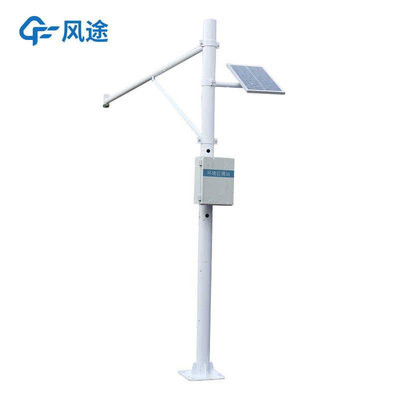
Accurate measurement of downstream river water level is important regardless of the type of discharge. Real-time grasp of water level changes can provide a scientific basis for flood control dispatching and timely warning of possible flood risks; at the same time, it can also provide data decisions for the rational use of water resources and river ecological protection. So, how to measure the downstream river water level accurately and efficiently? The River Level Monitoring Station provides the answer. The River Level Monitoring Station under Fengtu is a representative based on radar technology.
The system adopts a non-contact measurement method, with the radar water level sensor as its core. The radar sensor emits high-frequency electromagnetic waves, which are reflected back when they encounter the water surface. The sensor calculates the water level height according to the propagation time and speed of the electromagnetic waves. This measurement principle is not affected by factors such as water flow speed, water quality, and floating objects, and can maintain stable measurement accuracy even under complex discharge conditions.
The Fengtu River Level Monitoring Station can automatically measure water level data at regular intervals and transmit the data to the monitoring center through a wireless communication module. The monitoring center can process, analyze and store the data, and staff can check the real-time changes of the downstream river water level through computers or mobile terminals. When the water level exceeds the preset threshold, it will immediately issue an acousto-optic alarm or a short message alarm to remind relevant personnel to take countermeasures in a timely manner.
The system is easy to install, and there is no need to deploy equipment underwater, which reduces the construction difficulty and the impact on the river ecology.
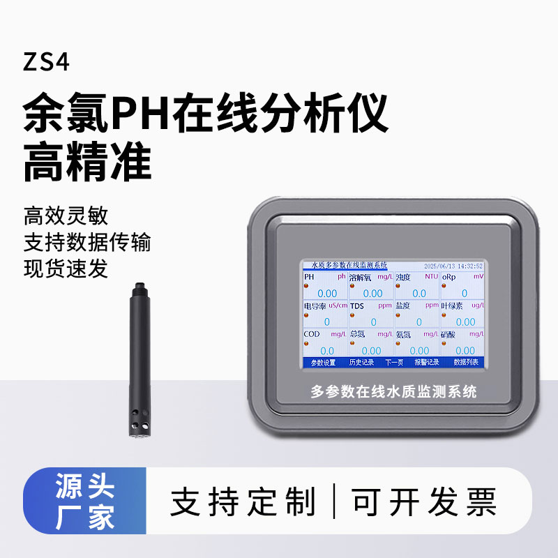
Multi-parameters Water Quality Analyzer can simultaneously monitor water quality parameters such as conductivity, pH, dissolved oxygen, ammonia nitrogen, turbidity, COD, and water temperature online. This instrument is easy to operate, provides rapid detection, and delivers accurate results, m...
The Termite Monitoring System is a specialized device designed for the prevention and monitoring of termites in buildings, characterized by its installation requirement to be buried in the soil surrounding structures. This design concept is derived from the biological habits of termites and their in...
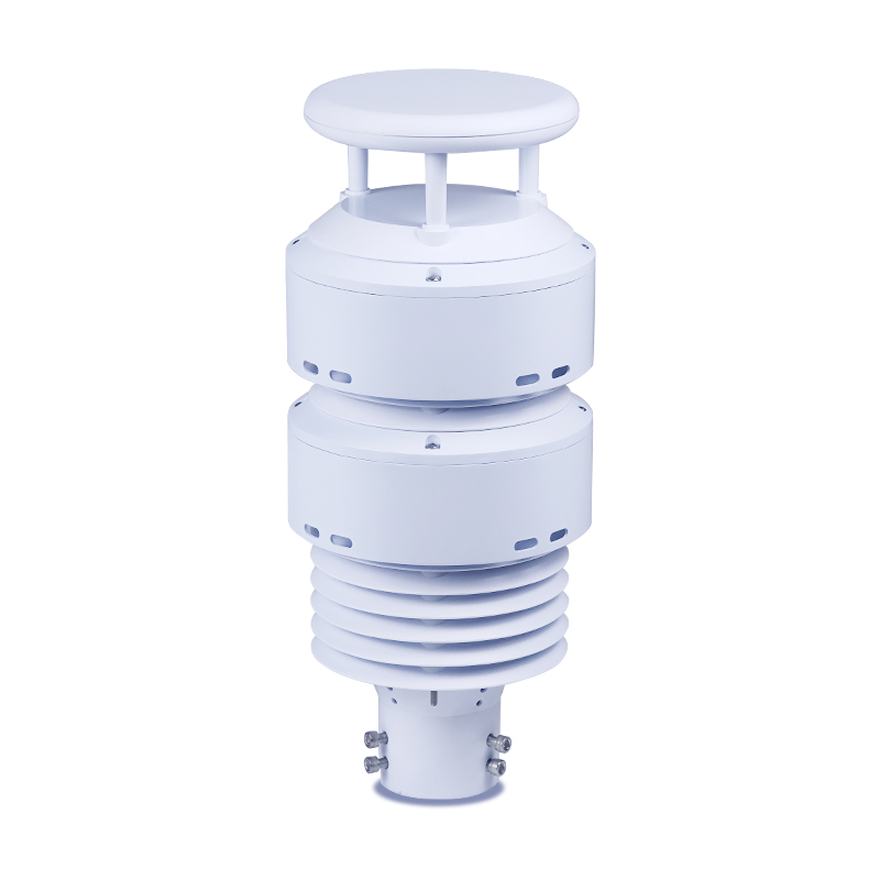
FT-WQX7, All-in-One Weather SensorsThe top cover hidden ultrasonic probe with physical shielding structure can effectively prevent rain and snow from accumulating on the probe surface to interfere with signal transmission and reception, and reduce the turbulence effect caused by direct impact of nat...
As a device widely used in fields such as water conservancy monitoring, environmental governance, and engineering construction, a flow meter can monitor water flow velocity data in real time with high accuracy, providing a scientific basis for decision-making. Currently, mainstream flow meters on th...


 Skype
Skype
 whatsapp
 mail
mail