Tianqiong Sensor IOT Technology Co., Ltd
Sales Manager:Ms. Emily Wang
Cel,Whatsapp,Wechat:+86 15898932201
Email:info@fengtutec.com
Add:No. 155 Optoelectronic Industry Accelerator, Gaoxin District, Weifang, Shandong, China


Sales Manager:Ms. Emily Wang
Cel,Whatsapp,Wechat:+86 15898932201
Email:info@fengtutec.com
Add:No. 155 Optoelectronic Industry Accelerator, Gaoxin District, Weifang, Shandong, China
time:2026-04-16 13:16:53 source:Weather Station viewed:244 time
The Geological Monitoring System employs Differential RTK technology to achieve millimeter-level displacement monitoring, making it suitable for the automated early warning of geological hazards such as landslides, rockfalls, and debris flows. Comprising GNSS monitoring stations, data acquisition units, and a cloud platform, the system supports continuous 24-hour online monitoring and remote data transmission.
The Geological Monitoring System is a product designed for millimeter-level displacement monitoring, realized through the application of Differential RTK (Real-Time Kinematic) technology. It is specifically engineered for the real-time surveillance and automated early warning of geological hazards—including landslides, rockfalls, and debris flows. The system consists of GNSS monitoring stations, data acquisition units, data transmission modules, and a cloud platform; it is capable of accurately detecting minute displacement changes in target objects across various complex environments, thereby enabling the automated, continuous, and real-time monitoring of the subject area.
The core technology of the GNSS monitoring stations is grounded in the principles of carrier-phase differential positioning. By deploying reference stations in stable zones and monitoring stations in areas prone to potential deformation, the system enables both sets of stations to simultaneously track common satellites. Through the application of differential algorithms, the system eliminates common errors—such as ionospheric delays and tropospheric refraction—to ultimately achieve high-precision coordinate solutions. The system supports multi-constellation satellite signals—including BeiDou, GPS, GLONASS, and Galileo—achieving a horizontal positioning accuracy of ±2.5 mm and a vertical accuracy superior to ±5 mm. This capability allows the system to capture slow creep signals involving displacements of just a few millimeters per day, enabling the identification of anomalous deformation trends during the initial stages of declining landslide stability. All monitoring data is uploaded in real-time to the cloud platform via communication channels such as 4G/5G, BeiDou short-message services, or LoRa. When the displacement rate or cumulative displacement magnitude exceeds pre-configured thresholds, the system automatically triggers a multi-tier early warning mechanism, notifying relevant personnel via SMS, mobile app push notifications, and audible/visual alarms.
In terms of practical application, the Geological Monitoring System has been successfully deployed at numerous geological hazard-prone sites across multiple provinces throughout the country. Jiangsu Province has strategically established 51 automated monitoring stations across the province, covering major types of geological hazards such as landslides, rockfalls, and ground subsidence. By deploying equipment such as integrated BeiDou units, rain gauges, and inclinometers, the province has constructed a specialized, integrated monitoring network spanning space, air, and ground domains. In a slope safety monitoring project at an open-pit mine in Gansu, Hi-Target integrated cutting-edge technologies—including high-precision BeiDou positioning, the Internet of Things (IoT), edge computing, and artificial intelligence—to construct a comprehensive monitoring and early-warning system. This system incorporates a suite of devices for GNSS-based surface displacement monitoring, stress monitoring, deep-seated displacement monitoring, groundwater level monitoring, video surveillance, rainfall monitoring, and acoustic-optical alarms. With an online rate consistently maintained at 100% across its 92 monitoring units, the system enables 24-hour real-time tracking of deformation conditions on the mine slopes. Huace Navigation’s independently developed H7 integrated, self-powered GNSS monitoring station consolidates core components—such as the receiver, solar power module, and communication module—into a single unit, allowing for rapid installation in areas lacking access to mains electricity. Equipped with a high-performance GNSS chip, the station captures millimeter-level terrain displacement changes in real time; furthermore, through the use of proprietary variable-frequency and embedded sleep technologies, it boasts an operational endurance of over 90 days, even during overcast or rainy weather. To date, 27 provinces across the country have established automated monitoring stations, covering more than 70,000 potential geological hazard sites.
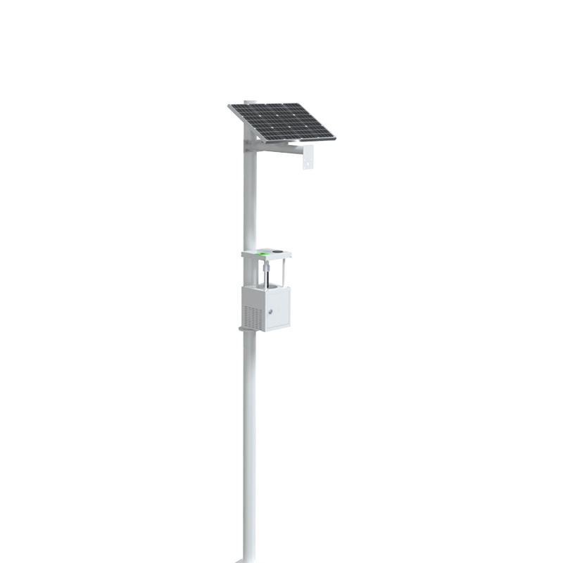
Pocket Weather Meter integrates sensors for wind speed and direction, temperature and humidity, atmospheric pressure, illumination, total radiation, ultraviolet radiation, and runway temperature, measuring multiple meteorological and road surface parameters in real time. The device employs ult...
China has a vast territory with complex and diverse geographical environments and significant differences in climatic conditions. As a crucial link for power transmission, transmission lines inevitably traverse special geographical areas such as valleys, high - altitude peaks, and rivers. These spec...
With the continuous progress of science and technology, refined meteorological monitoring has become an important development direction of modern meteorological services. The purpose of refined meteorological monitoring is to obtain more accurate, detailed, and high spatio-temporal resolution meteor...
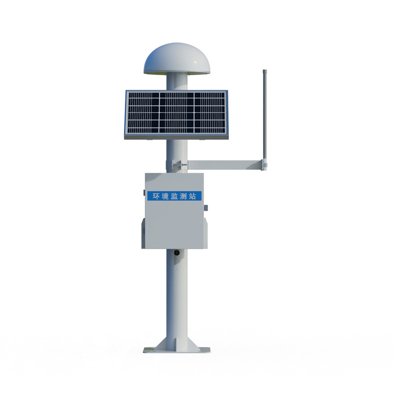
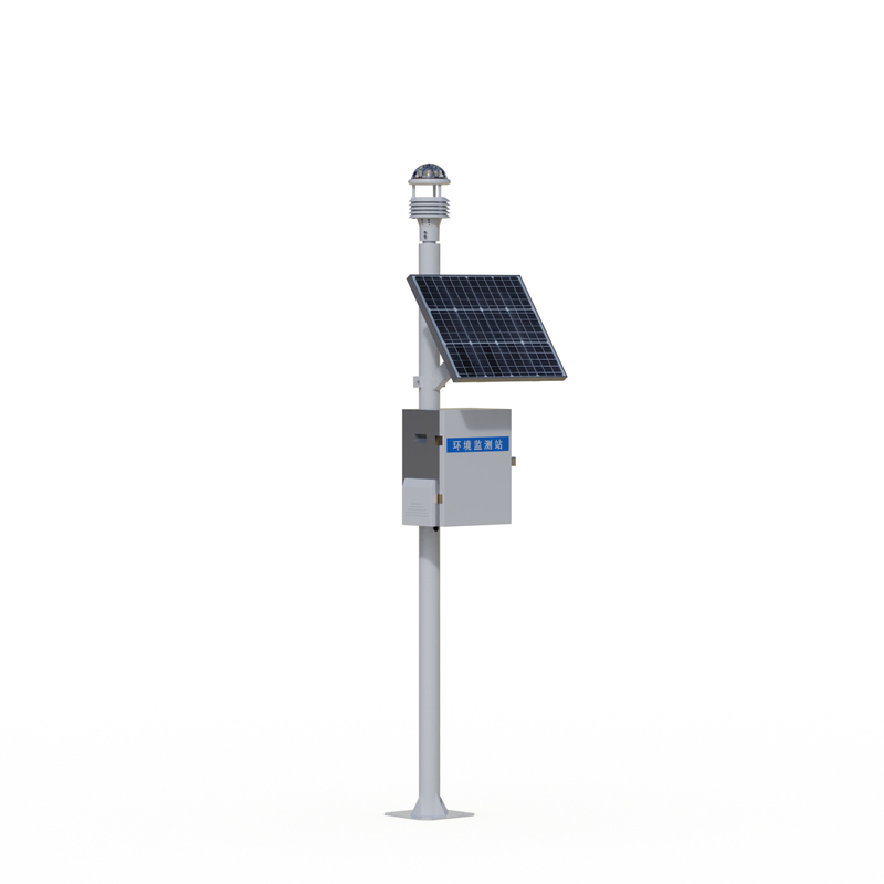
Complete Weather Station is designed in strict accordance with the observation standards of international meteorological organizations. Utilizing a configuration that combines a data logger with modular sensors, it is capable of measuring between ten and twenty meteorological parameters—inclu...


 Skype
Skype
 whatsapp
 mail
mail