Tianqiong Sensor IOT Technology Co., Ltd
Sales Manager:Ms. Emily Wang
Cel,Whatsapp,Wechat:+86 15898932201
Email:info@fengtutec.com
Add:No. 155 Optoelectronic Industry Accelerator, Gaoxin District, Weifang, Shandong, China


Sales Manager:Ms. Emily Wang
Cel,Whatsapp,Wechat:+86 15898932201
Email:info@fengtutec.com
Add:No. 155 Optoelectronic Industry Accelerator, Gaoxin District, Weifang, Shandong, China
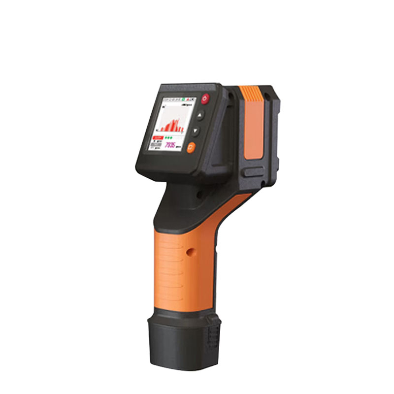
Model:FT-JW2
Brand:tianqiong
Laser method telemeter product introduction
Laser methane telemeter can detect the methane concentration value at the detection location in real time, quickly and safely detect methane leaks at a distance of 100m.Laser method telemeter is mainly used to measure the concentration of methane gas from a long distance. The telemeter emits an infrared laser to the detection point, which can quickly measure the concentration of the air mass between the detection point and the telemeter. For the convenience of observation, the telemeter also emits a visible green laser to the detection point at the same time. The methane concentration value at the checked position can be detected in real time and displayed, with high sensitivity, small size and easy operation.
Detection range: (0~100000) ppm·m
Testing object: methane (CH₄)
Detection principle: Laser absorption spectrum (TDLAS)
Detection distance: 100m
Static detection limit: 50ppm·m
Response time: 0.1s
Indication method: LCD displays real-time data and status, sound indicates alarm status
Working environment: temperature -20~60℃; humidity <90%RH (no condensation)
Working voltage: DC11.1V (lithium battery capacity 2800mAh)
Size: 240*122.5*80(mm)
Weight: about 0.6kg
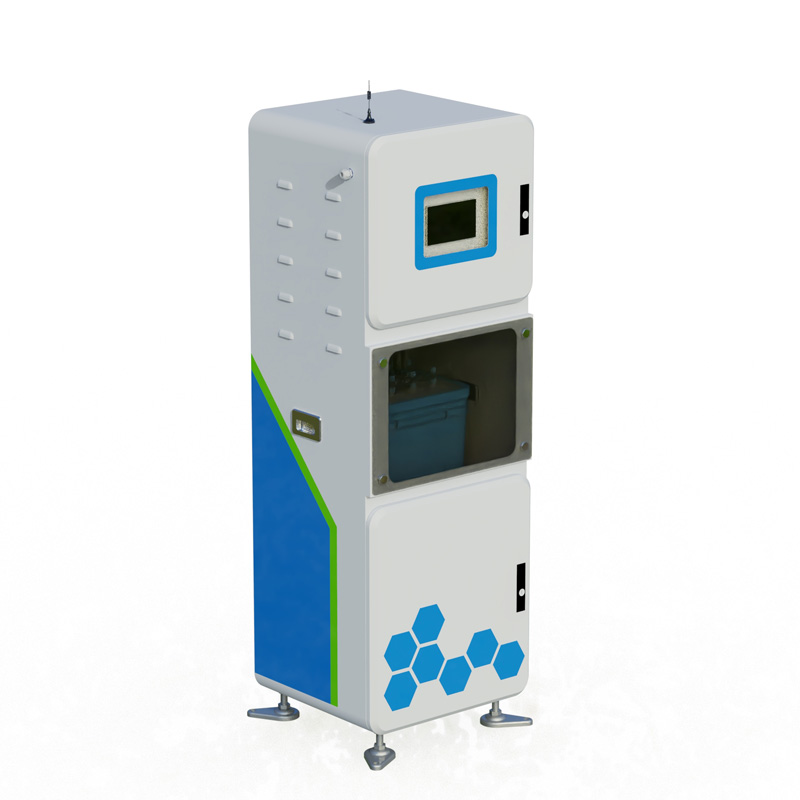
Integrated water quality analyzers enable online monitoring of key parameters such as conductivity, pH, dissolved oxygen, ammonia nitrogen, turbidity, COD, and water temperature. They support sensor expansion as well as the storage and export of historical data. Equipped with an RS485 interfac...
The FT-JL1 Automatic Monitoring Instrument for Runoff Sediment is a professional device used for real-time, automatic monitoring of soil erosion conditions. It can accurately measure runoff volume and sediment concentration, providing data support for environmental protection, disaster early warning...
The Portable Weather Station enhances monitoring convenience and efficiency with its lightweight, integrated design, meeting the demand for rapid and accurate acquisition of meteorological data across multiple fields.The core of achieving the lightweight and integrated design of such devices lies in...
Under harsh low - temperature and freezing conditions, anemometers and wind vanes are highly prone to malfunction. As a result, the errors in the collected data increase significantly. Although these devices are equipped with heating units, the units only function on the rotating parts. Once severel...


 Get a Free Quote
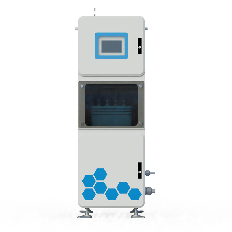
 Skype
Skype
 whatsapp
 mail
mail